
Highly detailed and congested sites are hard to survey using conventional survey techniques due to limited access and space and for other safety concerns. We have employed the relatively new 3D laser scanning technology in similar projects and produced excellent highly detailed 2D and 3D survey results. 3D laser scanning technology has many advantages over conventional survey techniques.
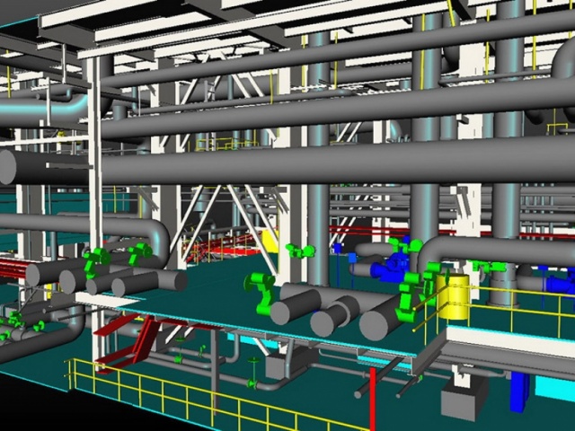
The surveyed site objects are remotely sensed using laser beam. Project site can be measured from various standing points without need for direct contact or occupation of the measured objects. This type of survey is excellent for survey of congested roadways; there is no need for full or partial road closing to obtain the required survey measurements. The resultant deliverables are highly detailed 3D replica model depicting the exact geographic position, dimensions, and actual surface color of the scanned object or surface in virtual space. Two and three-dimensional as-built plans can be generated from the 3D model for any top, side view, or cross section which can be used for any other engineering design application on any industry standard CADD application.
The generated 3D model, tied to common reference of coordinating system, reflecting the exact dimensions, shape, location of existing facilities and structures, greatly assist the design team. This best fits the newly planned expansion structures or facilities with great certainty. Digital photos are captured along with the scanning process from colors and textures of the scanned surfaces projected into the final 3D model, which helps the end user visualize and walk through the project site on his computer screen without any need for repeated site visits. 3D Laser scanning generates more details and therefore enables more versatile use of the generated object model.