

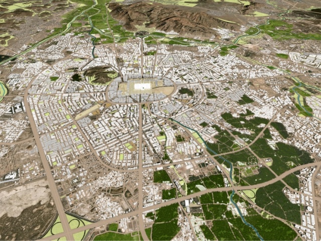
City master planning requires essential geospatial information about the land being master planned. Such information can be in the form of regional large-scale maps (transportation maps, utility maps, Public services location maps, subdivision maps, etc.) or other relevant non-spatial data such as population statistics, household average income, traffic intensity information, etc. TWOZAN SURVEYS has the tools and resources to provide its clients with reliable information that can be used as a basis for regional and city master planning. Our services include:
Establishment of multipurpose base maps for urban and regional planning.
Topographic and planimetric detail mapping for various purposes.
Flood plain mapping and terrain modeling.
Route planning support surveys for highways, roads, railways, and utility lines.
Surveys and data collection of traffic studies.
Demographic data collection, modeling, and representation of base maps. Cadastral and real estate boundary surveys and collection of other non-spatial data related to master planning.