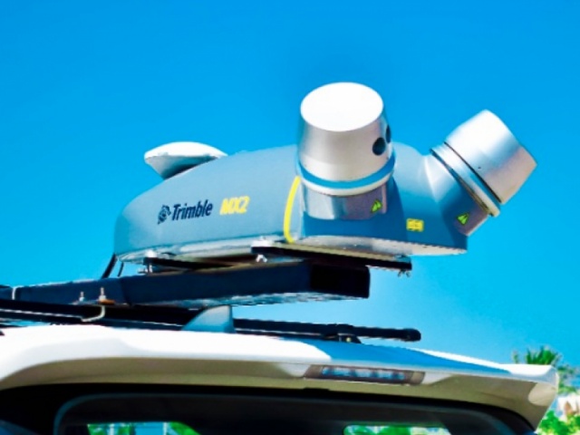
Today, the world is facing an accelerating and a great demand for modern data collection in terms of accuracy and density, and it was necessary to keep pace with this high demand for geospatial data by using a system that collects data quickly and is able to reach all areas that may be difficult to reach by traditional methods in surveying. The mobile mapping system has become one of the most widely spread systems that meet all the requirements of consultants, decision makers and users of Geographic Information System by building integrated geodatabases.
We at Twozan Surveys provide our clients with mobile mapping services, which can provide geospatial and imagery datasets that represents an integrated platform for all clients. These services includes, but are not limited to:
We at Twozan Surveys use the latest mobile mapping technologies to conduct these surveys. We use the latest technology in 3D laser scanning and spatial imaging as modern method when conducting these surveys. It provides the most accurate measurement and creates rich data sets based on survey data.